Danville
Default Location: Danville Park and Ride

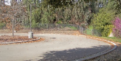
The Danville Park and Ride is a big parking lot right off Interstate 680. Halfway between the Dublin and Walnut Creek interchanges (approximately 7 miles each from highways 24 and 580), take the Sycamore Valley Road EAST off ramp in Danville. On the east side of the freeway, turn left at the Park and Ride stoplight to enter a long asphalt lot. Skate lessons take place at the far end away from traffic. Look for my white Ford Explorer.
(If agreed on in advance) Danville Town Service Center
On Interstate 680 halfway between San Ramon and Walnut Creek, use the Sycamore Valley Road EAST off ramp. Follow that a couple miles, veering right at the Y to stay on Camino Tassajara. Turn left at the stop light for Sherburne Hills, the corner with the big church and a US Post Office on your left. Pass all the PO driveways and take the next left driveway into the Danville Town Service Center parking lot. (Big sign on the building). Look for my white Ford Explorer.
Fremont
Frank Fisher Park and School

Heading south on Interstate 880 in Fremont, take the Alvarado / Fremont exit and stay in the middle lane. Cross the boulevard to enter Deep Creek Road. Proceed 1 mile to the Paseo Padre light and continue straight one block further. On the right, you will see the sign for Frank Fisher Park on the corner. Drive past the big grassy area and turn right on Maybird Circle (same name as street where the sign is). Park at the curb close to the paved playground area.
Heading north on Interstate 880 in Fremont, exit west on Highway 84 (towards the Dumbarton Bridge). Take the first exit, Ardenwood Blvd. Turn right and follow Ardenwood less than a mile to Paseo Padre. Turn right, and then turn right again on Deep Creek. One block down on the right, pass the sign for Frank Fisher Park to get to the far side (south) and turn right on Maybird Circle (same name as street where the sign is). Park at the curb close to the paved playground area.
Richmond
Miller Knox Shoreline Park
Here is where I teach: a delicious, large concrete pad set back from the asphalt parking lot.

From Interstate 80 in Albany, take the Interstate 580 exit north, heading toward the Richmond-San Rafael Bridge. About 1.5 miles before the toll plaza, take the Garrard exit and turn left, heading west under the freeway. Take the first right and at the next stop sign turn left. Go through the tunnel, after which Garrard becomes Dornan Drive. On the west side of the tunnel, you'll find Miller/Knox Shoreline Park on your right. Pass the obvious parking lots and park on the curb outside the closed second lot.
Alameda
Crown Memorial Beach
For now , I cannot teach here anymore. The parking lots need to be repaved.

From Interstate 980 in downtown Oakland, exit at 11th/12th Streets, go through several traffic lights, and make a left onto Fifth Street just beyond the 880 underpass. This will take you to Broadway and the Oakland/Alameda Tube.
Approaching Oakland from the south, exit Interstate 880 at Broadway. Turn left on Broadway and left again into the Oakland/Alameda Tube. Once through the Tube, you'll be on Webster Street, which you should follow to its end at Central Avenue. Go left on Central one block then turn right on 8th. The street curves toward the bay and you will see the entrance to Crown Memorial Beach on the right. There is a $5 parking fee, but your dollars support the East Bay Regional Park District, who maintains the best skate trail network in the entire state!I'll be waiting for you in a parking lot on the left, next to my white Ford Explorer.
